Come on a journey through Peru’s peatlands, learn about these vibrant ecosystems and see how they compare with the peat bogs of Scotland.
This exhibition presents a selection of photographs taken by researchers from the Universities of St Andrews, Edinburgh and Leeds, and the Instituto de Investigaciones de la Amazonía Peruana (Institute for Research on the Peruvian Amazon) during our fieldwork in Peru’s Amazonian peatlands. You are not alone if haven’t heard of these landscapes before. We would like to take you on a virtual tour of the ecosystems, fieldwork and people in these peatlands to illustrate their local and global importance.
Peatlands are a distinctive type of ecosystem where the surface vegetation contributes to, and lives on top of, layers of accumulating peat. Peat is made up of leaves, roots and partially decomposed organic matter, which builds up when waterlogged, low-oxygen, low-nutrient conditions prevent decomposer organisms from recycling dead plant remains. Over tens to thousands of years, a thick layer of carbon-rich peat accumulates.
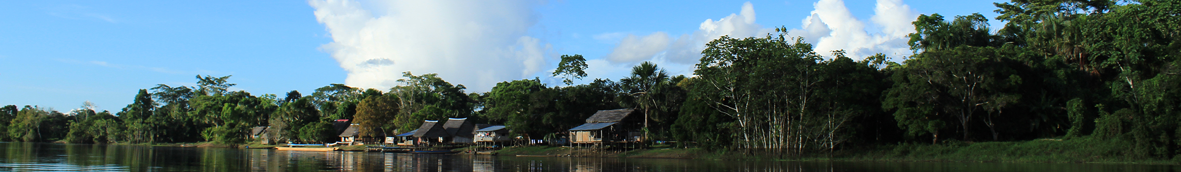
In Scotland, the most common type of peatland is a blanket bog, where layers of peat carpet the bedrock, forming waterlogged, mossy and shrubby landscapes. In the Peruvian Amazon, peatlands look very different as they are generally forested and often flooded; they are the archetypal ‘swamp.’
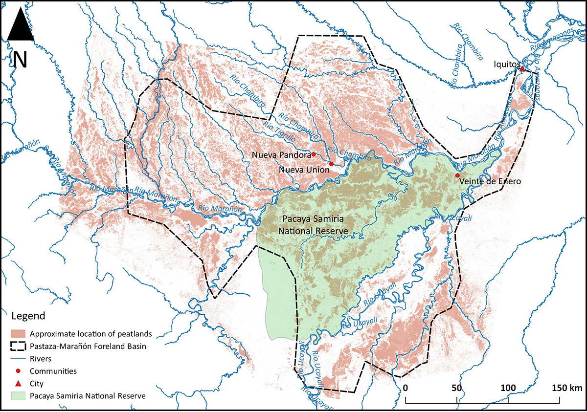
This map shows the distribution of peatlands (brown) in an area of northern Peru known as the Pastaza-Marañón Basin (outlined), where our research is based. The map was made using a combination of satellite data, field surveys of peat thickness and vegetation, and lab measurements of peat carbon content. The area covered by peatland is 35,000 km2—about the size of Belgium—and holds 3,140,000,000 tonnes of carbon, most of which is stored below ground as peat. This is equivalent to about half the amount of carbon stored in all of Peru’s forests, which cover a much larger area, or about seven years’ worth of UK carbon dioxide emissions.
As well as measuring and mapping the distribution of carbon, our group is researching the biodiversity and long-term dynamics of these peatland ecosystems, to understand how they develop over centuries to thousands of years. We are also researching the value, meaning and cultural importance of the peatlands to the communities who live there.
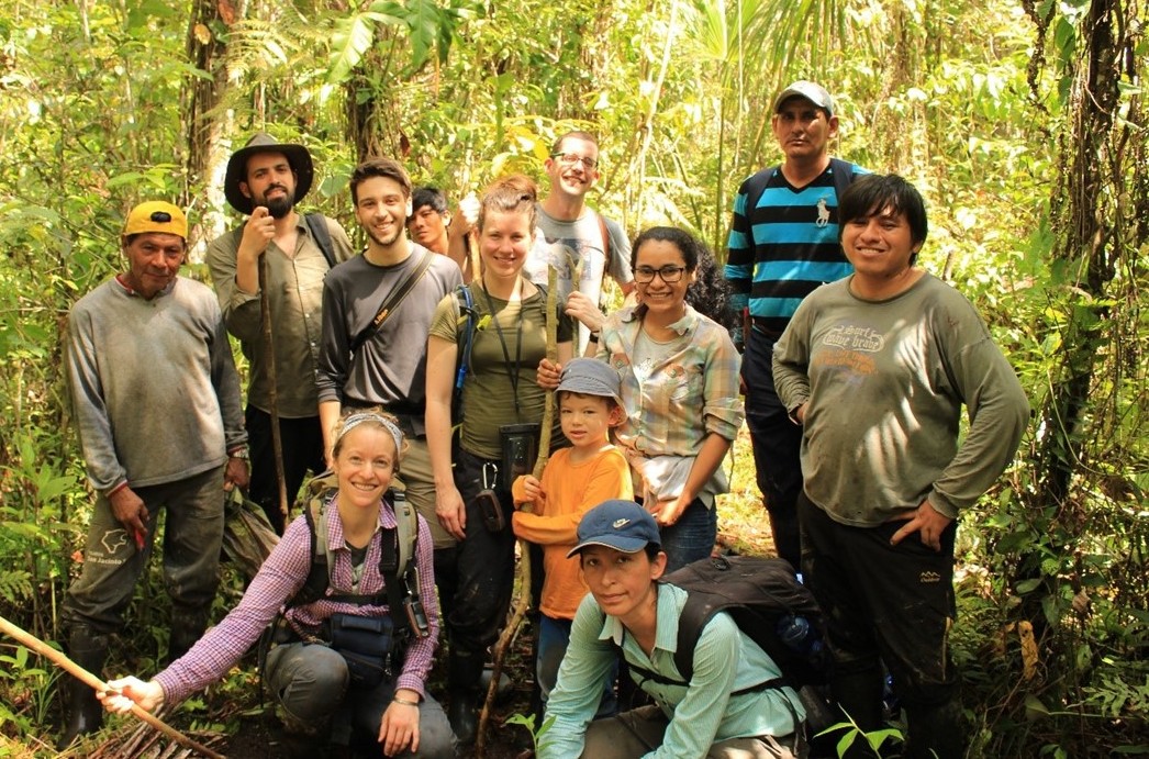
This photograph shows some of the members of our large team of researchers who are working together to answer questions about how Peru’s Amazonian peatlands function and their importance to people. Bringing together an interdisciplinary team of researchers means we can combine ecological, sociological and anthropological evidence with the aims of ensuring the long-term protection of carbon stocks in intact peatlands in the Amazon, and of bringing environmental, ecological, and cultural benefits to local communities.
The photographs in this exhibition were taken by our research team across ten years of field work, and have been selected to provide an insight into not only these peatland ecosystems and the people who live in and around them, but also the experience of doing research in these environments.
You can find out more about the different projects and team members at the Tropical Wetlands Consortium.
Exhibition compiled by Lydia Cole, Katy Roucoux and Althea Davies with contributions from Nina Laurie, Euridice Honorio, Ian Lawson and Esther Rutter, School of Geography and Sustainable Development, University of St Andrews. Thanks to the British Ecological Society for the Outreach Grant which funded the exhibition.